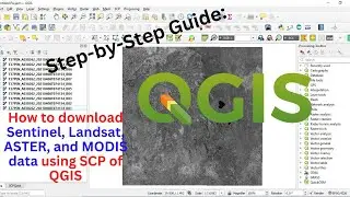
Step-by-Step Guide: How to download Sentinel, Landsat, ASTER, and MODIS data using SCP of QGIS
In this video tutorial, you will learn how to download Sentinel, Landsat, ASTER, and MODIS satellite data using the SCP (Semi-Automatic Classification Plugin) of QGIS.


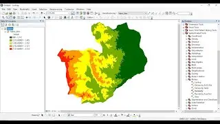
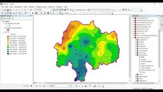
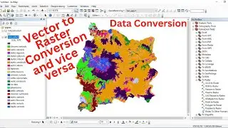
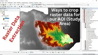
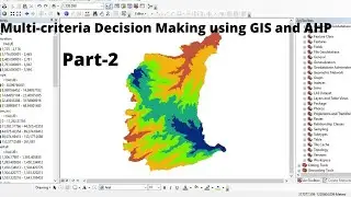
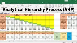
![How to Perform Land Suitability Evaluation: Step-by-Step Tutorial [Full]](https://images.mixrolikus.cc/video/IEuV2VT4RzQ)