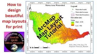
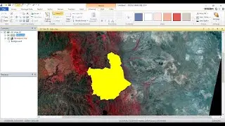
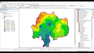
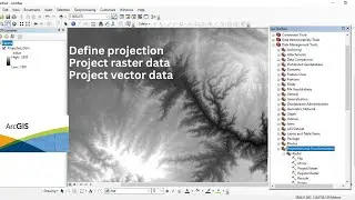
Define projection, and project raster and vector data using ArcGIS software
This video tutorial is to show you how to define projection for vector data, and how to project raster and vector data (how to change the coordinate system of the data) using ArcGIS software.


![李克勤版本的《晚风心里吹》哀而不伤 内敛深情 [精选中文好歌] | 中国音乐电视Music TV](https://images.mixrolikus.cc/video/Amd_N31T3pQ)


![How to Perform Land Suitability Evaluation: Step-by-Step Tutorial [Full]](https://images.mixrolikus.cc/video/IEuV2VT4RzQ)