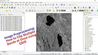
Image Preprocessing: How to Clip Multiple Bands at Once Using QGIS
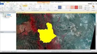
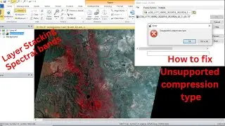
In this tutorial, you will explore how to clip multiple bands at once in QGIS, a free and open-source Geographic Information System (GIS) software. Clipping is a common preprocessing step in image analysis, where we extract a portion of an image within a defined boundary.
Related content:
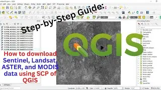
Step-by-Step Guide: How to download Sentinel, Landsat, ASTER, and MODIS data using SCP of QGIS: • Step-by-Step Guide: How to download Sentin...


![How to Perform Land Suitability Evaluation: Step-by-Step Tutorial [Full]](https://images.mixrolikus.cc/video/IEuV2VT4RzQ)