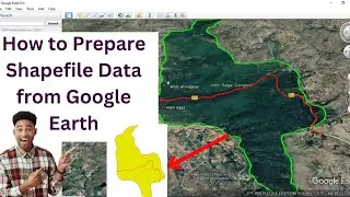
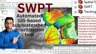
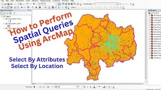
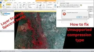
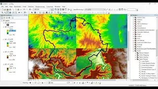
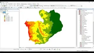
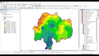
How to use GIS-based SWPT tool for Subwatershed Prioritization
This video is to show you how to prioritize sub-watersheds for conservation using the powerful GIS-based SWPT (Subwatershed Prioritization Tool). In this informative video, you will explore how this automated GIS-based tool helps you to identify and prioritize critical sub-watersheds. The tool computes all subwatershed morphometric and other parameters at once.


![How to Perform Land Suitability Evaluation: Step-by-Step Tutorial [Full]](https://images.mixrolikus.cc/video/IEuV2VT4RzQ)