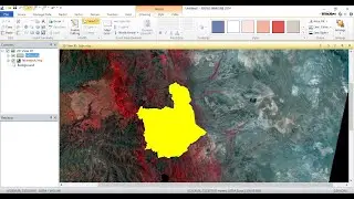
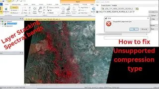
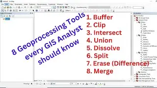
How to Create a Subset of Remote Sensing Data using ERDAS IMAGINE 2014
This video tutorial is to show you how to create a subset of remotely sensed data using ERDAS IMAGINE 2014. The benefit of creating subsets improves processing speed and reduces file sizes.
Don't forget to like and subscribe for more tutorials on GIS and remote sensing analysis and image processing with ERDAS IMAGINE.


![How to Perform Land Suitability Evaluation: Step-by-Step Tutorial [Full]](https://images.mixrolikus.cc/video/IEuV2VT4RzQ)