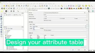
Convert Shapefile to KML in QGIS and open in Google Earth
Keyhole Markup Language (KML) is a file format used to display geographic data in an Earth browser such as Google Earth. KML uses a tag-based structure with nested elements and attributes and is based on the XML standard. This video demonstrates how to convert Shapefile to KML in QGIS. What are the advantages of KML? Let’s know you’re your views in the comment section
Subscribe for more videos:
/ @geojaygissolution4856
Related videos:
How to convert shapefile layer to KML/KMZ in ArcGIS: • How to convert Shapefile Layer to KML...
Join Excel sheet to shapefile data in ArcGIS: • Join Excel Sheet To Shapefile Data In...
Merge layers in QGIS: • Merge Layers In QGIS
Download Digital Elevation Model (DEM) from USGS: • Download Digital Elevation Model (DEM...