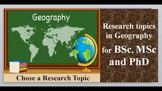
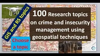
100 Research topics on crime and insecurity management using geospatial techniques
#researchtopics #crimemapping #Geospatialtechniques #crime #security #viral #tutorial #viralvideos #gis #data #spatial #map
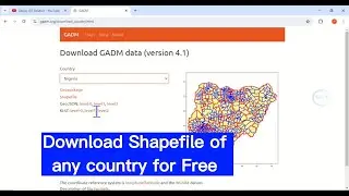
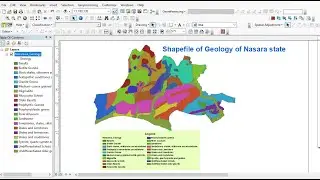
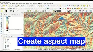
Geospatial techniques have become increasingly valuable in crime and insecurity management. By mapping and analyzing crime data, law enforcement can identify hot spots, allocate resources more effectively, and develop targeted strategies. Geographic information systems (GIS) allow for the visualization and analysis of crime patterns, aiding in predictive policing and evidence-based decision-making. Geospatial intelligence can also support emergency response and disaster management, enhancing overall public safety and security. This video shows you 100 research topics on crime and insecurity management using geospatial techniques. You are free to choose any of these topics for your next research or suggest them for your students, and modify as deem fit. Enjoy your watching and subscribe.
For business and enquiries: WhatsApp+2347065365193 or Email: [email protected]
Twitter/X: / geojay_gis
Subscribe for more videos:
/ @geojaygissolution4856
Related videos
Over 90 GIS and Remote Sensing research topics: Choose a project topic: • Over 90 GIS and Remote Sensing resear...
Nearest Neighbor Analysis: Find distribution pattern of features (Random, cluster or disperse): • Nearest Neighbor Analysis: Find distr...
Groundwater Potential Analysis: AHP pairwise comparison of groundwater potential factors/criteria: • Groundwater Potential Analysis: AHP p...
Raster and factors reclassification for site suitability analysis in ArcGIS: • Raster and factors reclassification f...
Morocco 2023 Earthquake Time Series Analysis in Google Earth: • Morocco 2023 Earthquake Time Series V...