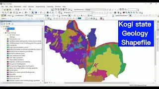
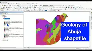
Geological map shapefile of Nigerian states: Geology of Nasarawa State Shapefile
#geologicalmap #geology #NGSA #Nigeria #mapping #viral #tutorial #viralvideos #gis #data #spatial #map
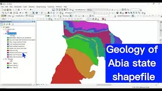
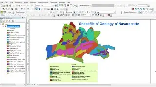
The information about the geology of Nigeria is provided and updated by the Nigerian Geological Survey Agency under the Ministry of Mines and Steel Development. The geological map is often provided in JPEG or PDF formats, making it not readily useable in GIS environment for analysis. We have embarked on converting the geological map of Nigeria to SHAPEFILE to make it easier for people to use especially for research purposes. The conversion is being done state by state using the official map from Nigerian Geological Survey Agency. One of the challenges encountered in this project is the inconsistency in the Nigeria boundary datasets, however we are doing this conversion maintaining the originality of NGSA without altering anything. The first state successfully converted and attributed to SHAPEFILE is that of Nasarawa state. This video shows you Geology of Nasarawa State Shapefile. Enjoy your watching and subscribe.
If you need this geological map SHAPEFILE send you request to the contact below
For business and enquiries: WhatsApp+2347065365193 or Email: [email protected]
Twitter/X: / geojay_gis
Subscribe for more videos:
/ @geojaygissolution4856
Related videos
The Soil Map Of Nigeria: • The Soil Map Of Nigeria
Nigerian states, LGAs and wards shapefiles with their population data: • Nigerian states, LGAs and wards shape...
Rainfall data for the 774 LGAs in Nigeria from 1981 to 2022: • Rainfall data for 774 LGAs of Nigeria
Nigeria River Basins: Shapefile: • Nigeria River Basins: Shapefile
Nigeria Healthcare facilities data shapefile: • Nigeria Healthcare facilities data sh...
Nigerian states and their landmass: Explore Nigeria: • Nigerian states and their landmass: E...