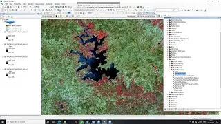
218 тысяч подписчиков
269 видео
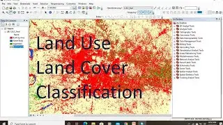
How to Create LULC using ArcGIS/ Supervised Classification and Calculate Area of LULC
ArcGIS Lesson-2 Digitization, Creation of shapefile & Map Layout in Arcgis
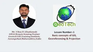
ArcGIS Lesson-1 Arcgis for beginners,Introduction of GIS,Georeferencing and Projection
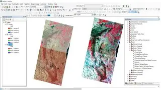
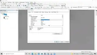
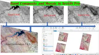
Band Composite & Mosaic of Landsat 8 data in ArcGIS
Georeferencing in ArcGIS & How to convert georeferenced image into KML
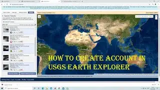
HOW TO CREATE ACCOUNT IN USGS EARTH EXPLORER & DOWNLOAD SATELLITE IMAGERY FREE
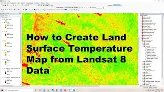
How to calculate land surface temperature from Landsat 8 Satellite Data
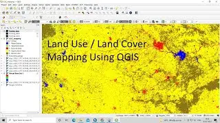
Land Use Land Cove (LULC) Mapping using QGIS || Landsat 8 Calssification using QGIS, Language Hindi
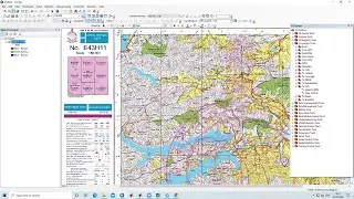
DOWNLOAD SURVEY OF INDIA TOPOSHEET|| HOW TO OPEN SURVEY OF INDIA TOPOSHEET IN QGIS
Download rainfall data from CHRS Data Portal
Drainage density or Stream Density Map using ArcGIS
Download Thematic Map Layer from Bhuvan || Download Geomorphology, LULC, Liniment Map from Bhuvan
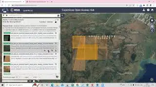
RS & GIS QA8- How to download sentinel-2 Satellite data from copernicus Open Access Hub
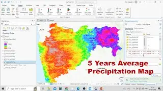
How to Create Average Annual Rainfall Map using ArcGIS Pro (5 Years Average precipitation Map)
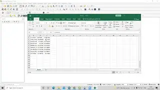
Excel file in QGIS || How to add CSV file in QGIS
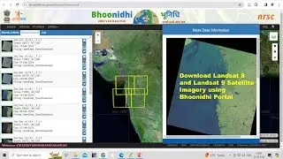
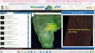
How to Download Landsat 8 and Landsat 9 Satellite Imagery from Bhoonidhi Portal for whole world
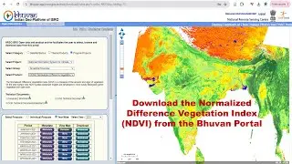
How to Download Normalized Difference Vegetation Index (NDVI) from Bhuvan Portal
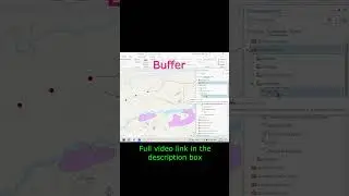
How to create a buffer or circle along point #shortsvideo
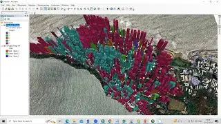
RS & GIS QA28 How to create 3D Building Model using ArcMap and Arc Scene
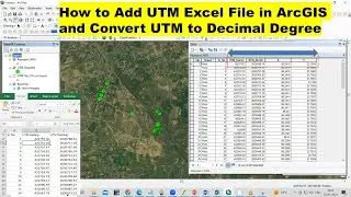
How to Add UTM Excel file in ArcGIS and Convert UTM to Decimal Degree
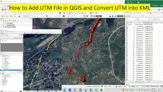
How to add UTM File in QGIS and Convert UTM to Kml
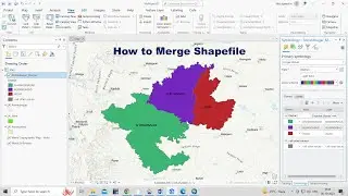
How to Merge Multiple Shapefile
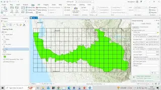
How to Create Fishnet or Sampling Grid in ArcGIS Pro
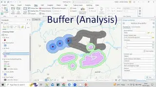
How to Create 3D Buffer in ArcGIS Pro
How to change the cell size of Raster image || Resampling in ArcGIS
How to Download Resourcesat2 LISS 4 satellite data from Bhoonidhi
Band composite of Sentinel 2 data or FCC image using ArcGIS
How to add Excel file in ArcGIS Pro #shortsvideo
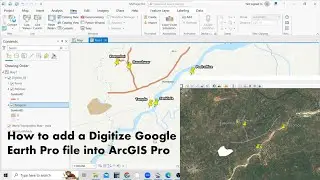
How to add a Digitize Google Earth Pro file into ArcGIS Pro
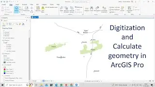
ArcGIS Pro 2 Digitization and Creation of Point, Line and Polygon Shapefile in ArcGIS Pro
How to Save World Satellite Imagery and Topographic Maps from ArcGIS and Open in ArcGIS Pro
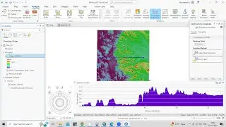
Profile Graph in ArcGIS Pro
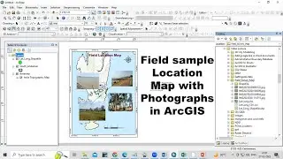
How to Prepare Field sample Location Map with Photographs in ArcGIS for absolute beginners
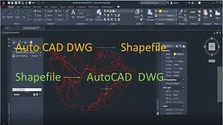
Converting AutoCAD File to ArcGIS Shapefile || Shapefile to Auto CAD file
QGIS Lesson-1 QGIS absolute beginners, Georeferencing & Projection
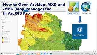
How to open ArcGIS .MXD and Map Package file in ArcGIS Pro Software
How to Download Aerial imagery
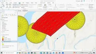
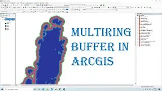
Multiring buffer in ArcGIS || Multiring Buffer Analysis in ArcGIS
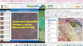
How to Download Sentinel-2 Satellite Imagery using Bhoonidhi Portal
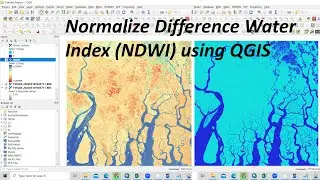
RS & GIS QA54 Normalize Difference Water Index (NDWI) using QGIS
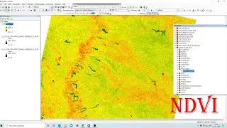
NDVI - Normalized Difference Vegetation Index || calculate NDVI using ArcGIS
How to create Band Composite and Mosaic using Landsat 8 Data in ArcGIS Pro
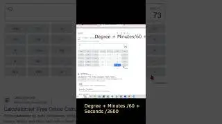
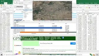
Degrees Minutes Seconds to Decimal Degrees
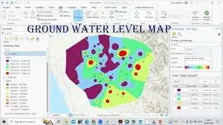
How to create Ground water level map or Depth to water level map using ArcGIS Pro
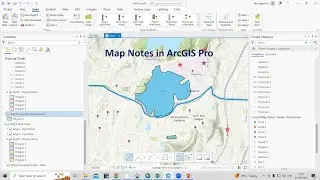
How to use Map Notes in ArcGIS Pro
RS & GIS QA61 How to Convert Multiple PDF file into TIff File using ArcMAP for absolute Beginners
Download ALOS PALSAR DEM 12.5 m Radiometric terrain correction Product
How to create buffer around point, line, and polygon shapefiles in ArcGIS Pro
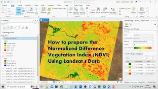
How to prepare the Normalized Difference Vegetation Index (NDVI) in ArcGIS Pro
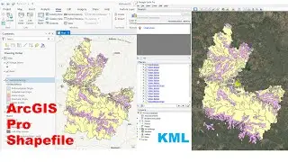
How to Convert ArcGIS Pro shapefile into Google Earth Pro kml File
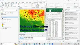
How to Extract Elevation Values from DEM using ArcGIS Pro
RS & GIS QA62 How to Insert google Map Link in Word Documents
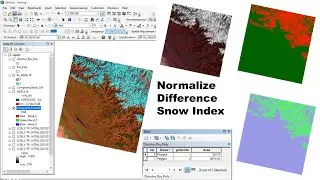
RS & GIS QA 63 How to Prepare Normalized Difference Snow index (NDSI) and calculate area of Snow
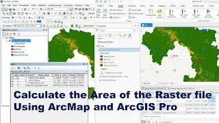
How to Calculate Area and Percentage of Raster Land Use Map using ArcMap and ArcGIS Pro
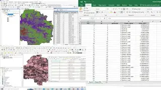
RS & GIS QA10 How to Export a Shapefile to Excel Spreadsheet in ArcGIS & QGIS
RS & GIS QA13- How to calculate the altitude of any place? Find Elevation from Latitude & longitude
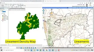
Lineament and lineament density map preparation using bhuvan data