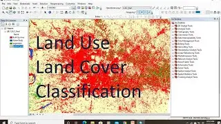
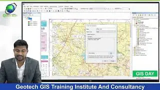
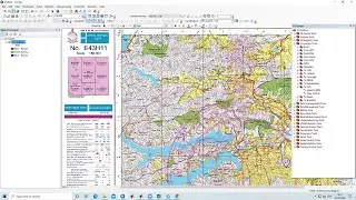
Georeferencing in ArcGIS & How to convert georeferenced image into KML
In this video lesson, we will learn how to Georeferencing Survey Of India Toposheet using ESRI's ArcGIS Software and add georeferenced image into Google earth
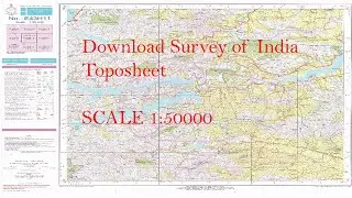
DOWNLOAD SURVEY OF INDIA TOPOSHEEThttps://studio.youtube.com/video/HLZr...
Join our telegram Group Remote Sensing & GIS Professionals:- https://t.me/joinchat/UhUorR2yhloKeKP...
lesson-1:- • QGIS Lesson-1 QGIS absolute beginners...
lesson-2 :- • QGIS Lesson-2 Digitization in QGIS, D...
Lesson-3:- • QGIS Lessons-3 Interface of Google Ea...
Lesson-4:- • QGIS Lessons-4 Download DEM,Create Sl...
Lesson-5:- • QGIS Lessons 5 Visualization of DEM i...
Lesson-6:- • QGIS Lesson 6 doubt clearing session ...
Any Help Contact
Mr.Vikas [email protected]
WhatsApp Number= +918421031398