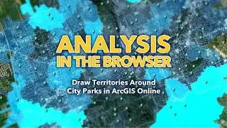
How to Draw Walkable Territories Around City Parks in ArcGIS Online
The ArcGIS Online map viewer has boatloads of geoprocessing tools (the beating heart of all GIS) right in the browser. For example, here's how to create territories around park points, and then stuff them with population data. Plus you'll get to see me dramatically reveal my glorious hair several times. Shock and awe.
0:00 Beautiful introduction
0:15 Drawing walking territories around city parks
2:00 What is a credit worth, you know, like, generally?
2:22 Knight Rider reference inspired by the progress doodad
2:30 Stuffing the new zones with population data
4:05 Styling up the park service areas as a thematic layer
4:28 Right in the back yard
Music: Doctor Turtle, Always the Teasmade, Never the Tease
Check out some other social channels where I share how-to's and updates on random map adventures:
http://adventuresinmapping.com
https://www.esri.com/arcgis-blog/auth...
/ john_m_nelson
/ johnmnelson
/ johnmnelson


