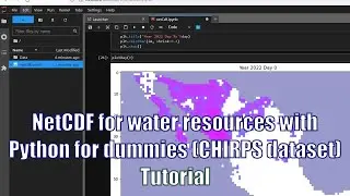
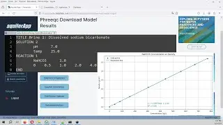
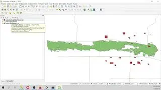
Extracting geological faults and orientation representation in QGIS with GeoTrace - Tutorial
Image from earth surface are available from satellite images and unmanned aerial vehicules (UAV). Image resolution ranges from 10 meters on free available datasets as Sentinel2, less than 1 meter on commercial satellite imagery to 0.05m (or even less) from UAVs. This tutorial show the procedure to install GeoTrace on QGIS 3 with its dependencies, runs a geological fault trace on a modified raster, calculate fault strike azimuths as a separate attribute field represent them as a strike rose.
Input data
Download the input data for this tutorial here:
https://www.hatarilabs.com/ih-en/extr...

![[FREE] SLIMESITO x BEEZYB TYPE BEAT 2022 -](https://images.mixrolikus.cc/video/1EoTITwenvE)