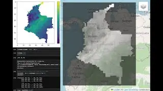
NetCDF for water resources with Python for dummies (CHIRPS dataset)
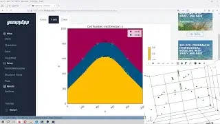
NetCDF has become a popular choice for storing and delivering precipitation and water resources related data. Its capacities to store multiple geospatial raster layers over time allow another level of abstraction on data analysis, however the format is of limited use on normal desktop applications and most times we are required to use a programming language such as Python or R.
Input data
You can download the input data from this link:
https://hatarilabs.com/ih-en/netcdf-f...