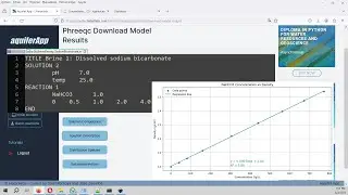
How to make a lake/reservoir volume-elevation curve with Python - Tutorial
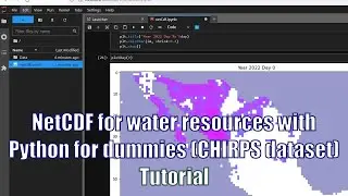
Python is a programming language capable of performing calculations for hydrological studies and water resources evaluations. We have done a tutorial for the volume-elevation curve determination of the lake Patillas in Puerto Rico with Python and numerical / spatial libraries as Numpy and Rasterio. Finally, results were compared to the volume-elevation curve form a USGS survey.
The procedure was done this time for a lake, but can be easily applied to any reservoir or water body when the bottom elevation is available as a raster file.
More info:
https://www.hatarilabs.com/ih-en/how-...