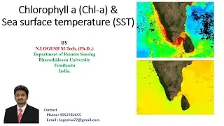
How to Download Chlorophyll a (Chl-a) and Sea surface temperature (SST)/ Analysis/ Aqua MODIS/SeaDas
#Chlorophyll a (Chl-a)
#Sea surface temperature (SST)
#SeaDas
#How to Download Chlorophyll a
#How to Download Sea surface temperature (SST)
#MODIS