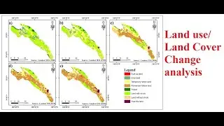
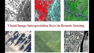
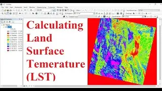
Visual Image Interpretation Keys in Remote Sensing
Visual Image Interpretation Keys in Remote Sensing
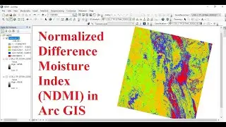
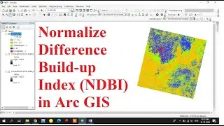
How to Interpret the satellite images
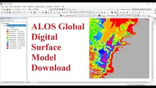
Pdf link-http://ecoursesonline.iasri.res.in/mo...
Visual Image Interpretation Keys in Remote Sensing
How to Interpret the satellite images
Pdf link-http://ecoursesonline.iasri.res.in/mo...