How to extract coordinates (Easting, Northing, Elevation) of any point |Using Google Earth
Welcome to the educational world...!
In this video we will talk about how we can get coordinates of any point/location using google earth and global mapper. Actually, we need coordinates of a point when we don't perform physical survey and for desk study or reconnaissance we use latitude and longitudes coordinates obtained from Google Maps or Google Earth.
1) What is Google Earth?
Google Earth is a computer program that renders a 3D representation of Earth based primarily on satellite imagery. The program maps the Earth by superimposing satellite images, aerial photography, and GIS data onto a 3D globe, allowing users to see cities and landscapes from various angles.
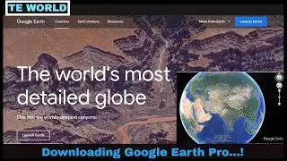
How to download google earth pro?
• How to Download and Install Google Ea...
2) What is Global Mapper?
Global Mapper is a geographic information system software package currently developed by Blue Marble Geo graphics that runs on Microsoft Windows. The GIS software competes with ESRI, Geo Media, Manifold System, and Map Info GIS products.
Click this link for Risa 2D tutorials
• Truss Analysis under Gravity loads us...
Staad Pro tutorials
• How to solve beam | Using Staad Pro
Windows 10 Installation complete guide
• How to download windows 10 and create...
#GoogleEarth#GlobalMapper#THEEDUCATIONALWORLD