SurveyTools for BricsCAD - Import and automate The Drafting Process With Seamless Integration
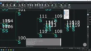
Survey software with a TOPO (Topographic) routine provides numerous advantages. It automates the creation of detailed topographic maps by extracting elevation data from survey measurements, significantly reducing manual effort. This feature improves accuracy, speeds up the mapping process, and enhances visualization, enabling surveyors to make informed decisions and deliver precise topographic representations for various applications.
Learn More
https://www.microsurvey.com/products/...
@BricsysOfficial
#bricsys #BricsCAD #BricsCADforCivilEngineering