Using Google My Maps as a Geotagging Questionnaire and Field Survey Application in Mobile Phone
Google My Maps enables collaborative spatial data creation with multiple users. Utilizing these advantages for field surveys will facilitate the rapid collecting or updating of geospatial data
00:06 Open Arcmap
00:12 Add Shapefile of Boundary
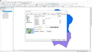
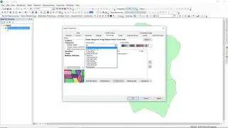
00:34 Setting Polygon as Hollow and also its Outline Color
00:50 Converting Shapefile to KML format
01:27 Open Google My Maps on browser
01:41 Create a new map
02:03 Import KML of Boundary
03:02 Create a new layer (which will contain the survey results)
03:48 Adding first point as template
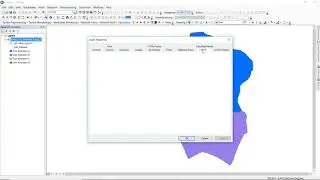
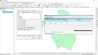
04:11 Setting attribute table
06:23 Sharing the editing access to other collaborators or surveyors
07:17 Open map on smartphone
08:00 Adding survey results