q
на канале: CAD Studio
Learn AutoCAD Civil 3D.
What you will learn from this course:
After completion of this course, you will be able to independently design Highway/Roads using AutoCAD Civil 3D. You will be able to create surfaces, design horizontal and vertical alignments, corridors, cross-sections and much more.
What are exactly the points covered in this course:
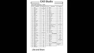
This course is divided into 7 sections and there are total 23 lectures, which are listed below:
About this Course
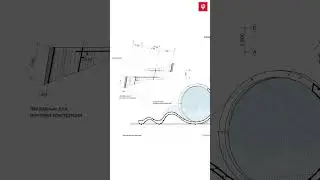
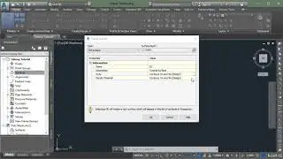
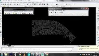
Overview of Surfaces
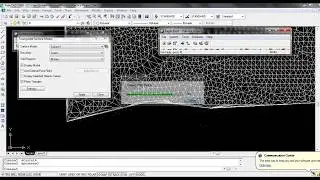
Creating Surface
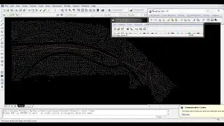
Adding Data to Surface using Point Files
Adding Data to Surface using Contours
Adding Data to Surface using Points Group
Labeling Surfaces
Overview of Alignments
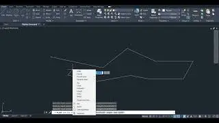
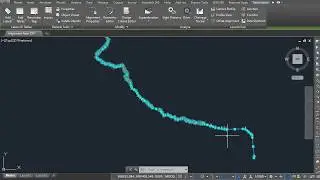
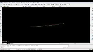
Creating Alignment from a Polyline
Creating Alignment Using Alignment Creation Tool
Alignment Labels and Label Styles
Editing Alignments
Overview of Profiles
Creating Surface Profile and Profile Views
Creating Design Profile
Profile Labels and Label Styles
Editing Profiles
Creating Assemblies and Subassemblies
Editing Assemblies and Subassemblies
Creating Corridors
Editing Corridors and Corridors Properties
Creating Sample Lines
Creating Cross Sections
The course is easy to follow; all of the resources needed are posted in the course content. What are you waiting for ! register now.
Who this course is for:
Transportation Engineering Students
Civil Engineering Students
Urban Engineering Students
Engineers working in Highway and Roads Industry
Surveyors
What you’ll learn
Independently Design Highways and Motorways using AutoCad Civil 3D.
Basic Concepts of Highway Design
Creating surfaces in AutoCad Civil 3D using survey data and defining survey boundaries
Editing the AutoCad Civil 3D surface properties and adding surface labels such as spot elevations, slope labels, and contour labels
Designing and editing alignments in AutoCad Civil 3D and use additional labeling tools such as stationing, tangent, and curve labels
Making a surface profile in AutoCad Civil 3D, which is dynamically linked to the existing ground
Building assemblies and subassemblies for building corridor
Construct a corridor model in AutoCad Civil 3D and analyze its anatomy
Creating sample lines for design road cross-sections using AutoCad Civil 3D
Are there any course requirements or prerequisites?
A basic understanding of AutoCAD.
Background of Civil Engineering, Transportation Engineering, Surveying or any other related discipline.
Knowledge of basic terminologies related Auto CAD, Highway Design and Surveying.
Who this course is for:
Civil Engineering, Transportation Engineering and Urban Engineering Students
Surveyors
Engineers working in Highway and Roads Industry
Overview of Surfaces in AutoCAD Civil 3D 2015.
Overview of Surfaces in AutoCAD Civil 3D 2018.


![HOW TO GET FISHMAN KARATE + SHOWCASE! [SQUARE PIECE]](https://images.mixrolikus.cc/video/hYK8KdZ8dW4)