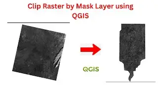
Clip Raster by Mask Layer in QGIS
This is a short video that shows you how to clip a raster by Mask layer.
1. Add both raster and vector data.
2. Go to Menu, under Raster, clip on Extraction.
3. Clip raster by Mask layer.
4. Enter Raster input and Vector inputs
5. Save the file