Digital Terrain Modelling illustration in Caddie .dwg Architecture compatible CAD software
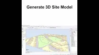
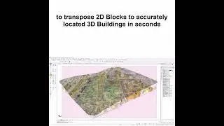
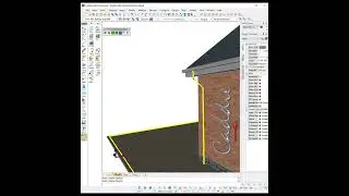
How to use Caddie's Digital Terrain Modelling Application to produce 3D site models from 2D site survey data. How to convert 2D levels to point locations in 3D space; create a 3D Triangular Irregular Network (TIN) model of your site; re-work site levels; perform cut and fill operations; draw contours automatically; and calculate site volumes. Learn how to smooth TIN models to a site mesh, and map an aerial photograph image onto your site, rotating and scaling the image automatically.
http://www.caddiesoftware.com/


![[Eng] Battletoads - Walkthrough (Sega Genesis) [1080p60][EPX+]](https://images.mixrolikus.cc/video/qFzAi1EwVKo)