ArcGIS Pro: Introduction to the interface and overview
Title: ArcGIS Pro: Introduction to Interface and Overview
arcgis pro 3.0 setup https://drive.google.com/file/d/1hndV...
Welcome to our YouTube tutorial on ArcGIS Pro! In this video, we'll provide you with a comprehensive introduction to the interfaces and give you an overview of this powerful geographic information system (GIS) software.
ArcGIS Pro, developed by Esri, is a cutting-edge GIS application that allows you to visualize, analyze, and manage spatial data effectively. Whether you're a GIS professional, a student, or someone interested in exploring the world of geospatial analysis, this tutorial will help you get started with ArcGIS Pro.
In this video, we will cover the following key topics:
Introduction to ArcGIS Pro: We'll begin by explaining what ArcGIS Pro is and why it has become a preferred choice for GIS professionals worldwide. You'll learn about its intuitive user interface, its capabilities, and how it differs from other GIS software.
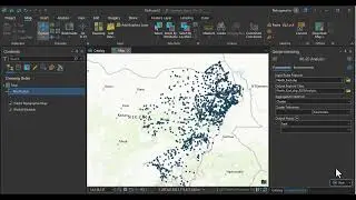
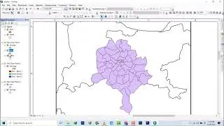
Interface Overview: We'll provide a guided tour of the ArcGIS Pro interface, familiarizing you with its various components and tools. You'll become acquainted with the ribbon, the map view, the catalog pane, the geoprocessing pane, and other essential elements that enable you to perform GIS tasks efficiently.
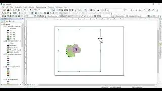
Map Authoring: We'll dive into map authoring, where you'll discover how to create and customize maps in ArcGIS Pro. You'll learn how to add and symbolize layers, modify symbology, create map layouts, and use the wide range of cartographic tools available.
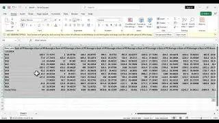
Data Management: Managing spatial data is crucial in any GIS project. We'll explore the data management capabilities of ArcGIS Pro, including importing and exporting data, creating geodatabases, organizing and querying data, and performing basic data editing tasks.
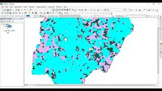
Analysis and Geoprocessing: ArcGIS Pro offers a vast array of geoprocessing tools for spatial analysis. We'll showcase some of the commonly used tools and demonstrate how to perform spatial queries, conduct proximity analysis, perform raster analysis, and generate useful geospatial insights.
Sharing and Collaboration: Once you've created your maps and conducted analysis, we'll guide you through the process of sharing your work with others. You'll learn how to publish maps and data as web services, create interactive web maps, and collaborate with colleagues using ArcGIS Online.
Whether you're new to GIS or transitioning from other GIS software, this tutorial will give you a solid foundation in ArcGIS Pro's interfaces and capabilities. By the end of this video, you'll feel confident navigating the software and utilizing its powerful features to accomplish your GIS tasks effectively.
If you're ready to unlock the full potential of ArcGIS Pro, don't forget to subscribe to our channel for more informative tutorials, tips, and tricks. Hit the like button if you find this video helpful, and share it with others who might benefit from it.
Get ready to explore the world of ArcGIS Pro and take your geospatial analysis to new heights. Let's get started!
connect with me via social
twitter @aprokosurveyor
instagram _
youtube
Hire me on fiver https://www.fiverr.com/s/aXK9kQ?utm_s...


![[FREE] Hard Trap Type Beat 2021](https://images.mixrolikus.cc/video/tmPvUw6c2AE)