How to Make Animated Maps with ArcGIS Maps for Adobe and Adobe After Effects
As designers, we have all had a project that required a map. And for those of us with limited cartography background, the process usually involves stitching together a series of screenshots, stock photography or tracing a map from some kind of reference found online.
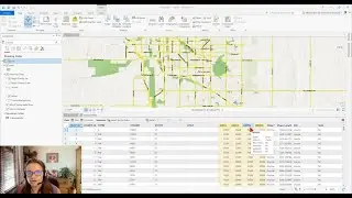
With ArcGIS Maps for Adobe Creative Cloud — a free extension for Illustrator and Photoshop — designers now have access to geographic data in a native format, making it easier to tell deeper stories around the data that actually connects us.
Download ArcGIS Maps for Adobe: http://ow.ly/Pv3B50zASn2
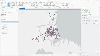
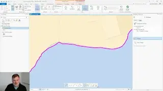
In this example, we will walk through the process of how to access spatial content from Adobe Illustrator to create and animate various ferry routes around NYC:
-We will import population data and create a vector base map with the help of spatial content available with ArcGIS Maps for Adobe Creative Cloud.
-We will then animate the data on the map in Adobe After Effects.
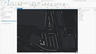
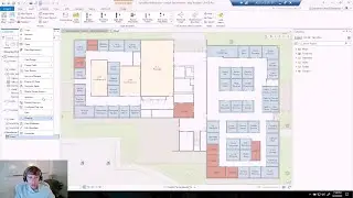
00:12 Part 1: Launching ArcGIS Maps for Adobe Creative Cloud from Adobe Illustrator
05:17 Part 2: Preparing files for animation in Adobe Illustrator
12:13 Part 3: Animating Spatial data in After Effects
Read the step-by-step guide: http://ow.ly/Yjpr50zFghj
Download the data (free) used in this lesson: https://www.arcgis.com/home/item.html...
---------------------------------------------------------------------------------------------------
Follow us on Social Media!
Twitter: / mapsforadobe
Facebook: / mapsforadobe
Instagram: / mapsforadobe
The Science of Where: http://www.esri.com