1 тысяч подписчиков
120 видео
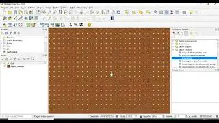
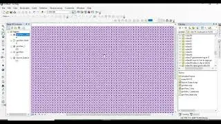
Create point grid or fishnet of specified interval for an area of interest in QGIS
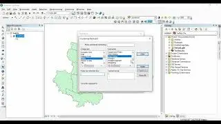
Download Administrative boundaries of any country upto subdivision level from GADM in R
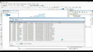
Combine/ Concatenate and split fields in ArcGIS attribute tables
Download SRTM DEM in R
Formatting map annotations in ArcGIS: Superscript and subscript
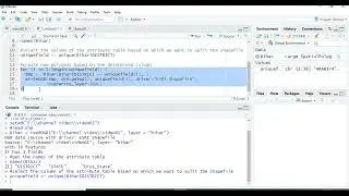
Changing the case (capitalize, small case, title case) of texts in ArcGIS attribute table
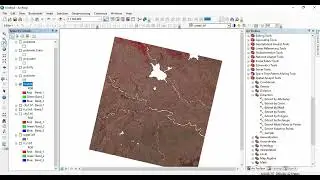
Splitting multi-polygon shape files and saving them to separate files in ArcGIS
Converting KML/KMZ file to shape file without losing attributes
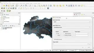
split multi polygon vector to separate files in QGIS
Resampling rasters in ArcGIS
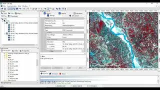
Image Sharpening/ PAN Sharpening/ Image Fusion in SAGA GIS
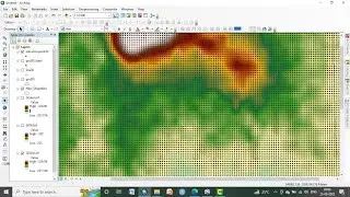
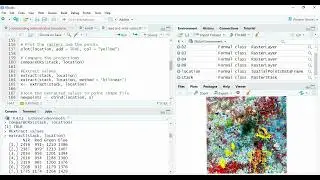
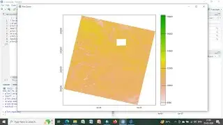
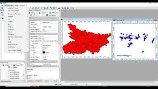
Extract raster values to points in QGIS
Create point grid or fishnet of specified interval for an area of interest in SAGA GIS
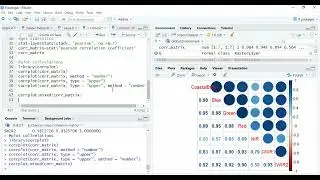
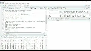
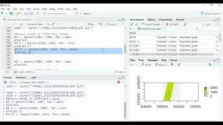
Plot correlation matrix from rasters in R
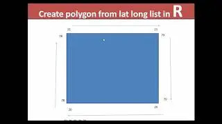
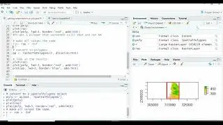
Create a polygon shapefile from list of longitude and latitude in R
Download open source Digital Elevation Model up to 8 m resolution
Extract/ Add raster values to polygons in R
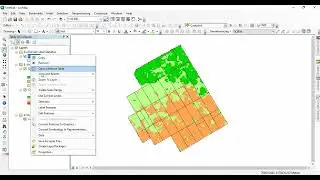
Object Based Image Segmentation in SAGA GIS (Open source software)
Buffer in ArcGIS: outside buffer, inside buffer, buffer for multiple polygons, multi ring buffer
Delineation of Watersheds from Digital Elevation Model (DEM) in R
Erase raster with raters in ArcGIS and R
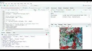
Split multi-polygon shapefile into separate shapefiles in R
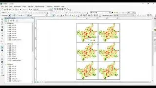
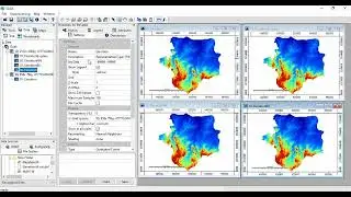
Showing multiple maps in a single layout in ArcGIS
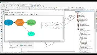
Create point grid or fishnet of specified interval in ArcGIS
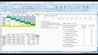
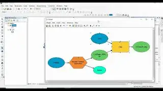
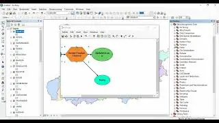
Deriving weights of multi criteria decision analysis with Analytical Hierarchy Process (AHP)
Clipping a vector file with each polygon of a multi-polygon vector
Batch Processing large number of shapefiles in ArcGIS
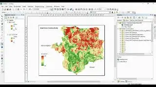
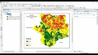
Add classified raster value to polygons in ArcGIS
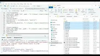
Read netcdf file of IMD rainfall and get weekly rainfall in raster format in R
Creating monthly rainfall rasters from IMD rainfall data in netcdf format and saving separately
Resampling Rasters in SAGA GIS with different downscaling mathods
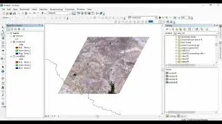
Clipping a raster with a multi-polygon feature in QGIS
Extracting Digital Elevation Model from Google Earth
Mosaic single/ multiple band rasters in R
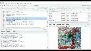
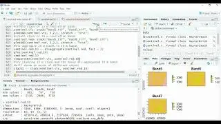
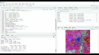
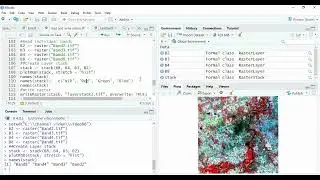
Reading, layerstacking and writing rasters in R using Raster and Terra packages
Download Village/ taluka/ district/ state boundaries from Survey of India in shapefile format
Download MODIS Data in R upto 200 km x 200 km without login
Extract/ Add raster values to points in R
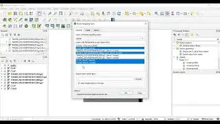
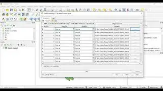
Clip/ extract multiple Rasters in a folder in QGIS
Extracting raster extent and boundary as polygons in R
Changing names and type of fields in shape files using ArcGIS and SAGA GIS
Erase a raster with a raster or vector in R
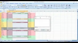
Fill blank cells in Excel with desired formula
Create shortcut keys for any tool in ArcGIS
Formatting map annotations in ArcGIS: Color of Legend text same as color palette
Resample Rasters in R. Solution for Error in compareRaster(x) : different extent
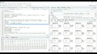
Principal Component Analysis of Raster images in R
Write RasterStack and preserve layer names in R
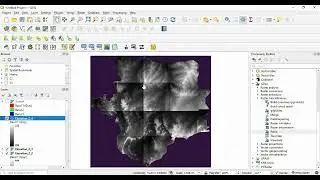
Split rasters in to tiles of desired size in QGIS
Layer to kml in SAGA GIS